
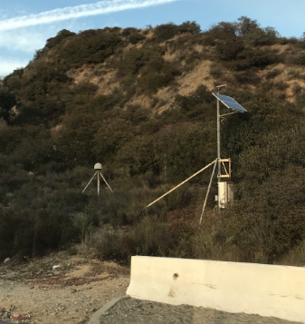
 Point of reference: tripod in bedrock (Photo by S. Holmes)
 Have you ever wondered whether your water capture projects have increased groundwater supply?
I went to a lecture by Cathleen Jones, a radar scientist at the Jet Propulsion Laboratory. Jones said that she measures the height of the ground with a radar device on an airplane. Using GPS, she can compare, over time, changes in the elevation. If there is too much pumping of a particular well, she will see it because of the subsidence; the land literally falls.
In my head, I could see that data being really valuable to validate the use of swales. (A swale is a water-harvesting ditch.) I contacted Jones and set up a meeting with Water LA, which is part of The River Project, and Pasadena Water and Power to talk about just that.
At the meeting — Jones brought along another JPL research scientist, Andrea Donnellan — we learned that there is so much data that no one has had a chance to look at it all. Donnellan pulled up some data on her laptop computer. She said it was the first time she had ever looked at that particular data. She pointed at one point on a map that indicated where there is a tripod screwed into bedrock (see photo). As solid, non-moving items those tripods help with GPS whenever the researchers fly over with radar and do measurements; they act as points of reference. (Everything the scientists do has to be relative to something else.)
Jones explained that when you want to measure ground water and you use subsidence as one of your tools, it’s helpful but that doesn’t mean it’s the only tool you are using. With data analysis you can make a model, overlaying data on top of data on top of data. And then you can talk about the actual water. It is still assumptions about the water but through pooling data you can make more informed assumptions. (Yes, I felt like I was in science class; it was really fascinating.)
There is data on subsidence going all the way back to 2009. And data is continually being added as they continue to fly over. Hopefully, there is data that we can mine.
My goal is to find out, retroactively, whether some swales and other water catchment projects have caused less subsidence. I’d like to overlay two maps: one map of the conservation work and where it is, and one map of the data showing subsidence (or lack thereof).
Both scientists thought there was enough interesting data to justify a study of some kind. The conclusion was that we need to find a recent PhD graduate to take an interest and do a study.
Do you know anybody who would be interested?
—Sylvia Holmes
Beautiful Swales